 vesseltracker.com
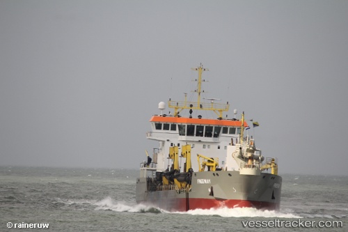
 Freeway
Current Status
Where is the vessel?
Freeway is currently in Near Barrow In Furness, based on AIS data received about 14h ago.
Latest AIS update:
Current position: 54.07911° N, 3.20315° W (Near Barrow In Furness)
Average speed (last 7 days): Loading…
Average speed (last 30 days): Loading…
Vessel profile: Freeway is a Hopper Dredger with dimensions 92m x 92m.
This page combines live AIS, route history, probable destination signals, nearby traffic, and port activity for practical vessel monitoring.
The current position of vessel Freeway is 54.07911 lat / -3.20315 lng. Updated: 2026-05-17 22:03:10 UTCNearest reference points:
- Near LIVERPOOL ANCH
- Near BIRKENHEAD
- Near ELLESMERE
Currently sailing under the flag of Cyprus ![]()
Details:
Live Vessel Freeway Analytics (details, animations, etc.)
Recent AIS points (UTC):
2026-05-17 17:43:50 UTC · 53.98529, -3.23326 · SOG 10.7 kn · COG 341°2026-05-17 19:38:28 UTC · 54.01058, -3.21536 · SOG 12.4 kn · COG 33°
2026-05-17 19:49:39 UTC · 54.04228, -3.16981 · SOG 14.3 kn · COG 24°
2026-05-17 22:03:10 UTC · 54.07911, -3.20315 · SOG 1.1 kn · COG 120°