 GOUSEA
Current Status
Where is the vessel?
GOUSEA is currently in 16 nm S of Ketu, based on AIS data received about 14h ago.
Latest AIS update:
Current position: 6.37033° N, 3.90730° E (16 nm S of Ketu)
Average speed (last 7 days): Loading…
Average speed (last 30 days): Loading…
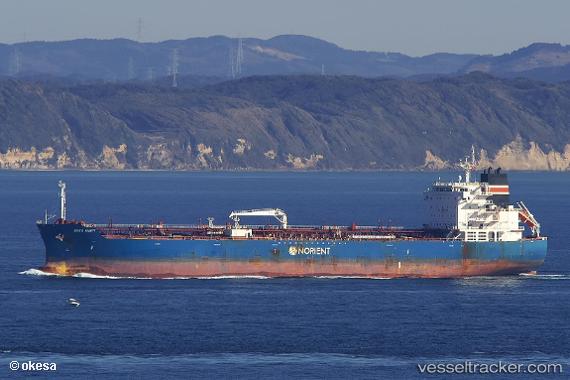
Vessel profile: GOUSEA is a Tanker with dimensions m x m.
This page combines live AIS, route history, probable destination signals, nearby traffic, and port activity for practical vessel monitoring.
The current position of vessel GOUSEA is 6.37033 lat / 3.90730 lng. Updated: 2026-05-18 21:44:13 UTCNearest reference points:
- Near Lagos
- Near Apapa
- Near Kirikiri
Currently sailing under the flag of Marshall Islands ![]()
Details:
Live Vessel GOUSEA Analytics (details, animations, etc.)
Recent AIS points (UTC):
2026-05-18 17:00:22 UTC · 6.36667, 3.88833 · SOG 0 kn · COG -1°2026-05-18 19:06:22 UTC · 6.36833, 3.88833 · SOG 0 kn · COG -1°
2026-05-18 20:18:21 UTC · 6.36667, 3.88833 · SOG 0 kn · COG -1°
2026-05-18 21:44:13 UTC · 6.37033, 3.90730 · SOG 6.9 kn · COG 95°