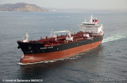
Garden State
Current StatusWhere is the vessel?
Garden State is currently in 117 nm SW of Port Saint Joe, based on AIS data received about 14h ago.
Latest AIS update:
Current position: 28.25167° N, 86.65523° W (117 nm SW of Port Saint Joe)
Average speed (last 7 days): Loading…
Average speed (last 30 days): Loading…
Vessel profile: Garden State is a Chemical Oil Products Tanker with dimensions 32m x 186m.
This page combines live AIS, route history, probable destination signals, nearby traffic, and port activity for practical vessel monitoring.
The current position of vessel Garden State is 28.25167 lat / -86.65523 lng. Updated: 2026-05-22 15:32:03 UTCNearest reference points:
- Near Lynn Haven
- Near Miramar Beach
- Near Lillian
Details:
Live Vessel Garden State Analytics (details, animations, etc.)
Recent AIS points (UTC):
2026-05-22 12:40:05 UTC · 28.77871, -87.14856 · SOG 14 kn · COG 142°2026-05-22 12:40:05 UTC · 28.77871, -87.14856 · SOG 14 kn · COG 142°
2026-05-22 15:32:03 UTC · 28.25167, -86.65523 · SOG 14.6 kn · COG 142°
2026-05-22 15:32:03 UTC · 28.25167, -86.65523 · SOG 14.6 kn · COG 142°