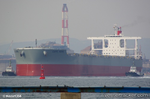
 Cape Hope
Current Status
Where is the vessel?
Cape Hope is currently in Open sea (no nearby ports in database), based on AIS data received about 14h ago.
Latest AIS update:
Current position: 22.80699° S, 9.44285° W (Open sea (no nearby ports in database))
Average speed (last 7 days): Loading…
Average speed (last 30 days): Loading…
Vessel profile: Cape Hope is a Bulk Carrier with dimensions 299m x 299m.
This page combines live AIS, route history, probable destination signals, nearby traffic, and port activity for practical vessel monitoring.
The current position of vessel Cape Hope is -22.80699 lat / -9.44285 lng. Updated: 2026-05-19 04:55:21 UTCNearest reference points:
- Open sea (no nearby ports in database)
- Open sea, approx. 453 nm off the nearest listed port
- Open sea, approx. 451 nm off the nearest listed port
Currently sailing under the flag of Panama ![]()
Details:
Live Vessel Cape Hope Analytics (details, animations, etc.)
Recent AIS points (UTC):
2026-05-19 01:29:39 UTC · -22.46301, -9.97530 · SOG 10.7 kn · COG 110°2026-05-19 01:32:50 UTC · -22.46613, -9.96560 · SOG 10.7 kn · COG 111°
2026-05-19 03:44:50 UTC · -22.68231, -9.62343 · SOG 10.5 kn · COG 125°
2026-05-19 04:55:21 UTC · -22.80699, -9.44285 · SOG 10.6 kn · COG 126°