 NIGHTINGALE ISLAND
Current Status
Where is the vessel?
NIGHTINGALE ISLAND is currently in 73 nm SE of Finike, based on AIS data received about 14h ago.
Latest AIS update:
Current position: 35.23121° N, 30.86860° E (73 nm SE of Finike)
Average speed (last 7 days): Loading…
Average speed (last 30 days): Loading…
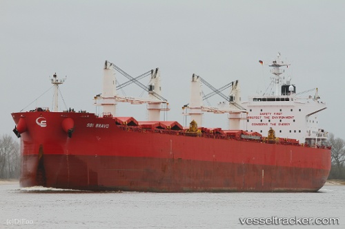
Vessel profile: NIGHTINGALE ISLAND is a Bulk Carrier with dimensions 32m x 200m.
This page combines live AIS, route history, probable destination signals, nearby traffic, and port activity for practical vessel monitoring.
The current position of vessel NIGHTINGALE ISLAND is 35.23121 lat / 30.86860 lng. Updated: 2026-05-19 08:16:01 UTCNearest reference points:
- Near Finike
- Near Kemer
- Near KAS
Currently sailing under the flag of Hong Kong, China ![]()
NIGHTINGALE ISLAND built in 2015 year
Deadweight:
61587 tDetails:
Live Vessel NIGHTINGALE ISLAND Analytics (details, animations, etc.)
Recent AIS points (UTC):
2026-05-19 04:25:54 UTC · 35.04946, 29.94819 · SOG 11.9 kn · COG 74°2026-05-19 05:47:53 UTC · 35.10333, 30.27333 · SOG 12 kn · COG -1°
2026-05-19 07:01:12 UTC · 35.16267, 30.56949 · SOG 12.2 kn · COG 74°
2026-05-19 08:16:01 UTC · 35.23121, 30.86860 · SOG 12 kn · COG 75°