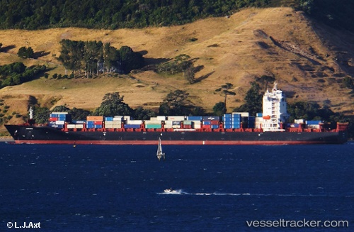
Wiking
Current StatusWhere is the vessel?
Wiking is currently in 117 nm SW of Port de Boké, based on AIS data received about 14h ago.
Latest AIS update:
Current position: 9.20818° N, 16.18640° W (117 nm SW of Port de Boké)
Average speed (last 7 days): Loading…
Average speed (last 30 days): Loading…
Vessel profile: Wiking is a Container Ship with dimensions 38m x 255m.
This page combines live AIS, route history, probable destination signals, nearby traffic, and port activity for practical vessel monitoring.
The current position of vessel Wiking is 9.20818 lat / -16.1864 lng. Updated: 2026-05-22 16:26:38 UTCNearest reference points:
- 97 nm SW of Port de Boké
- 79 nm SW of Conakry
- 144 nm SW of Bubaque
Details:
Live Vessel Wiking Analytics (details, animations, etc.)
Recent AIS points (UTC):
2026-05-22 13:58:58 UTC · 8.83463, -15.92340 · SOG 11 kn · COG 321°2026-05-22 14:22:57 UTC · 8.89397, -15.96780 · SOG 11 kn · COG 321°
2026-05-22 16:13:56 UTC · 9.17500, -16.16330 · SOG 11 kn · COG -1°
2026-05-22 16:26:38 UTC · 9.20818, -16.18640 · SOG 11.1 kn · COG 324°