 vesseltracker.com
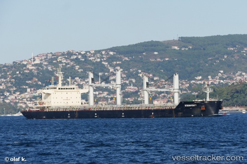
 MAI TAI
Current Status
Where is the vessel?
MAI TAI is currently in Near Le Kram, based on AIS data received less than 1h ago.
Latest AIS update:
Current position: 36.81440° N, 10.43948° E (Near Le Kram)
Average speed (last 7 days): Loading…
Average speed (last 30 days): Loading…
Vessel profile: MAI TAI is a Bulk Carrier with dimensions 179m x 32m.
This page combines live AIS, route history, probable destination signals, nearby traffic, and port activity for practical vessel monitoring.
The current position of vessel MAI TAI is 36.81440 lat / 10.43948 lng. Updated: 2026-05-17 04:04:56 UTCNearest reference points:
- Near Le Kram
- 13 nm N of Qulaybiyah
- 32 nm N of Qulaybiyah
Currently sailing under the flag of Liberia ![]()
MAI TAI built in 2015 year
Deadweight:
38792 tDetails:
Live Vessel MAI TAI Analytics (details, animations, etc.)
Recent AIS points (UTC):
2026-05-17 01:41:30 UTC · 36.81400, 10.43886 · SOG 0.1 kn · COG 334°2026-05-17 01:41:30 UTC · 36.81400, 10.43886 · SOG 0.1 kn · COG 334°
2026-05-17 03:44:34 UTC · 36.81422, 10.43919 · SOG 0 kn · COG 319°
2026-05-17 04:04:56 UTC · 36.81440, 10.43948 · SOG 0.2 kn · COG 310°