 GOLDEN ISLE
Current Status
Where is the vessel?
GOLDEN ISLE is currently in 140 nm W of Alozaina, based on AIS data received about 14h ago.
Latest AIS update:
Current position: 36.85885° N, 17.75217° W (140 nm W of Alozaina)
Average speed (last 7 days): Loading…
Average speed (last 30 days): Loading…
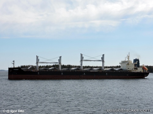
Vessel profile: GOLDEN ISLE is a Bulk Carrier with dimensions 179m x 32m.
This page combines live AIS, route history, probable destination signals, nearby traffic, and port activity for practical vessel monitoring.
The current position of vessel GOLDEN ISLE is 36.85885 lat / -17.75217 lng. Updated: 2026-05-18 19:58:16 UTCNearest reference points:
- 78 nm W of Nedroma
- 150 nm NW of Ponta do Pargo
Currently sailing under the flag of Marshall Islands ![]()
GOLDEN ISLE built in 2015 year
Deadweight:
38767 tDetails:
Live Vessel GOLDEN ISLE Analytics (details, animations, etc.)
Recent AIS points (UTC):
2026-05-18 16:24:24 UTC · 36.80833, -16.92500 · SOG 11 kn · COG -1°2026-05-18 17:58:16 UTC · 36.83214, -17.28847 · SOG 11.1 kn · COG 274°
2026-05-18 19:40:04 UTC · 36.85413, -17.68283 · SOG 11.1 kn · COG 274°
2026-05-18 19:58:16 UTC · 36.85885, -17.75217 · SOG 11.3 kn · COG 276°