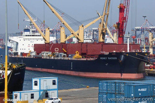
 HONEY BADGER
Current Status
Where is the vessel?
HONEY BADGER is currently in 26 nm W of HANSTHOLM, based on AIS data received about 14h ago.
Latest AIS update:
Current position: 57.19498° N, 7.81143° E (26 nm W of HANSTHOLM)
Average speed (last 7 days): Loading…
Average speed (last 30 days): Loading…
Vessel profile: HONEY BADGER is a Cargo with dimensions m x m.
This page combines live AIS, route history, probable destination signals, nearby traffic, and port activity for practical vessel monitoring.
The current position of vessel HONEY BADGER is 57.19498 lat / 7.81143 lng. Updated: 2026-05-19 01:50:03 UTCNearest reference points:
- Near Thyborøn
- Near HANSTHOLM
- Near Kristiansand
Currently sailing under the flag of Liberia ![]()
Details:
Live Vessel HONEY BADGER Analytics (details, animations, etc.)
Recent AIS points (UTC):
2026-05-18 23:00:44 UTC · 57.47057, 8.59005 · SOG 10.8 kn · COG 236°2026-05-19 00:06:25 UTC · 57.36466, 8.28639 · SOG 10.6 kn · COG 237°
2026-05-19 01:21:44 UTC · 57.24217, 7.94472 · SOG 10.9 kn · COG 239°
2026-05-19 01:50:03 UTC · 57.19498, 7.81143 · SOG 11 kn · COG 241°