 SEA DAWN
Current Status
Where is the vessel?
SEA DAWN is currently in 400 nm W of Porto Grande, based on AIS data received about 14h ago.
Latest AIS update:
Current position: 18.35707° N, 31.81978° W (400 nm W of Porto Grande)
Average speed (last 7 days): Loading…
Average speed (last 30 days): Loading…
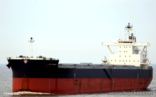
Vessel profile: SEA DAWN is a Cargo with dimensions m x m.
This page combines live AIS, route history, probable destination signals, nearby traffic, and port activity for practical vessel monitoring.
The current position of vessel SEA DAWN is 18.35707 lat / -31.81978 lng. Updated: 2026-05-19 09:26:23 UTCNearest reference points:
- Open sea, approx. 402 nm off the nearest listed port
- Open sea, approx. 403 nm off the nearest listed port
- Open sea, approx. 444 nm off the nearest listed port
Currently sailing under the flag of Marshall Islands ![]()
Details:
Live Vessel SEA DAWN Analytics (details, animations, etc.)
Recent AIS points (UTC):
2026-05-19 05:20:01 UTC · 17.77333, -32.43167 · SOG 12 kn · COG -1°2026-05-19 07:26:04 UTC · 18.06833, -32.11833 · SOG 12 kn · COG -1°
2026-05-19 08:11:07 UTC · 18.17500, -32.00667 · SOG 12 kn · COG -1°
2026-05-19 09:26:23 UTC · 18.35707, -31.81978 · SOG 11.9 kn · COG 45°