 vesseltracker.com
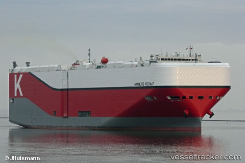
Hamburg Highway
Current StatusWhere is the vessel?
Hamburg Highway is currently in Near MIYAJIMA, based on AIS data received about 14h ago.
Latest AIS update:
Current position: 34.27799° N, 132.35156° E (Near MIYAJIMA)
Average speed (last 7 days): Loading…
Average speed (last 30 days): Loading…
Vessel profile: Hamburg Highway is a Vehicles Carrier with dimensions 38m x 199m.
This page combines live AIS, route history, probable destination signals, nearby traffic, and port activity for practical vessel monitoring.
The current position of vessel Hamburg Highway is 34.27799 lat / 132.35156 lng. Updated: 2026-05-18 07:48:33 UTCNearest reference points:
- Near Hiroshima
- Near Kure
- Near TSUWAJI
Details:
Live Vessel Hamburg Highway Analytics (details, animations, etc.)
Recent AIS points (UTC):
2026-05-18 04:25:19 UTC · 34.34771, 132.36591 · SOG 0 kn · COG 252°2026-05-18 05:49:23 UTC · 34.34769, 132.36591 · SOG 0 kn · COG 252°
2026-05-18 07:26:53 UTC · 34.33426, 132.36665 · SOG 7.7 kn · COG 190°
2026-05-18 07:48:33 UTC · 34.27799, 132.35156 · SOG 10.9 kn · COG 195°