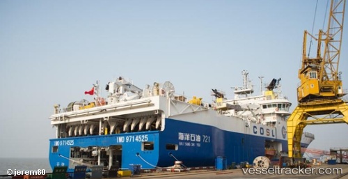
 HAI YANG SHI YOU 721
Current Status
Where is the vessel?
HAI YANG SHI YOU 721 is currently in 72 nm NW of Labuanbajo, based on AIS data received about 21h ago.
Latest AIS update:
Current position: 0.83156° N, 119.21191° E (72 nm NW of Labuanbajo)
Average speed (last 7 days): Loading…
Average speed (last 30 days): Loading…
Vessel profile: HAI YANG SHI YOU 721 is a Other Type with dimensions m x m.
This page combines live AIS, route history, probable destination signals, nearby traffic, and port activity for practical vessel monitoring.
The current position of vessel HAI YANG SHI YOU 721 is 0.83156 lat / 119.21191 lng. Updated: 2026-05-19 05:28:13 UTCNearest reference points:
- 69 nm E of Kaliorang
- 29 nm W of Labuanbajo
- 39 nm W of Labuanbajo
Currently sailing under the flag of Panama ![]()
Details:
Live Vessel HAI YANG SHI YOU 721 Analytics (details, animations, etc.)
Recent AIS points (UTC):
2026-05-19 05:28:13 UTC · 0.83156, 119.21191 · SOG 13.1 kn · COG -1°2026-05-19 05:28:13 UTC · 0.83156, 119.21191 · SOG 13.1 kn · COG -1°
2026-05-19 05:28:13 UTC · 0.83156, 119.21191 · SOG 13.1 kn · COG -1°
2026-05-19 05:28:13 UTC · 0.83156, 119.21191 · SOG 13.1 kn · COG -1°