 vesseltracker.com
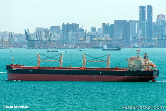
 ALIKI PERROTIS
Current Status
Where is the vessel?
ALIKI PERROTIS is currently in 12 nm NW of Yas Island, based on AIS data received about 7d ago.
Latest AIS update:
Current position: 24.44079° N, 52.43015° E (12 nm NW of Yas Island)
Average speed (last 7 days): Loading…
Average speed (last 30 days): Loading…
Vessel profile: ALIKI PERROTIS is a Bulk Carrier with dimensions 198m x 32m.
This page combines live AIS, route history, probable destination signals, nearby traffic, and port activity for practical vessel monitoring.
The current position of vessel ALIKI PERROTIS is 24.44079 lat / 52.43015 lng. Updated: 2026-05-11 01:54:43 UTCNearest reference points:
- Near Yas Island
- Near JABAL AZ ZANNAH
- Near Ar Ruways
Currently sailing under the flag of Marshall Islands ![]()
ALIKI PERROTIS built in 2015 year
Deadweight:
60897 tDetails:
Live Vessel ALIKI PERROTIS Analytics (details, animations, etc.)
Recent AIS points (UTC):
2026-05-11 01:54:43 UTC · 24.44079, 52.43015 · SOG 0.1 kn · COG 326°2026-05-11 01:54:43 UTC · 24.44079, 52.43015 · SOG 0.1 kn · COG 326°
2026-05-11 01:54:43 UTC · 24.44079, 52.43015 · SOG 0.1 kn · COG 326°
2026-05-11 01:54:43 UTC · 24.44079, 52.43015 · SOG 0.1 kn · COG 326°