 MANDARIN KAOHSIUNG
Current Status
Where is the vessel?
MANDARIN KAOHSIUNG is currently in 13 nm E of Itapoá, based on AIS data received about 14h ago.
Latest AIS update:
Current position: 26.14127° S, 48.35782° W (13 nm E of Itapoá)
Average speed (last 7 days): Loading…
Average speed (last 30 days): Loading…
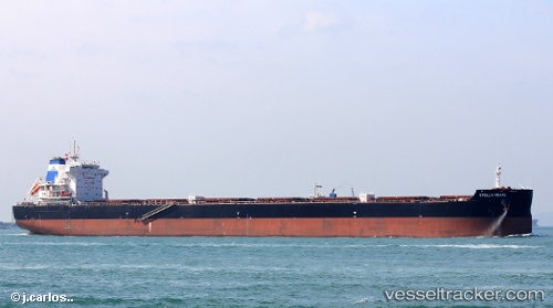
Vessel profile: MANDARIN KAOHSIUNG is a Cargo with dimensions m x m.
This page combines live AIS, route history, probable destination signals, nearby traffic, and port activity for practical vessel monitoring.
The current position of vessel MANDARIN KAOHSIUNG is -26.14127 lat / -48.35782 lng. Updated: 2026-05-20 16:36:29 UTCNearest reference points:
- 24 nm E of Caioba
- 32 nm E of Caioba
- 10 nm NE of CAMBORIU
Currently sailing under the flag of Marshall Islands ![]()
Details:
Live Vessel MANDARIN KAOHSIUNG Analytics (details, animations, etc.)
Recent AIS points (UTC):
2026-05-20 13:42:25 UTC · -26.14106, -48.35704 · SOG 0.4 kn · COG 168°2026-05-20 13:51:22 UTC · -26.14126, -48.35721 · SOG 0 kn · COG 161°
2026-05-20 16:06:27 UTC · -26.14116, -48.35768 · SOG 0.1 kn · COG 151°
2026-05-20 16:36:29 UTC · -26.14127, -48.35782 · SOG 0.1 kn · COG 151°