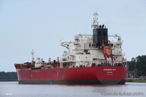
 Jennings Bay
Current Status
Where is the vessel?
Jennings Bay is currently in 137 nm W of Punta Chungo, based on AIS data received about 14h ago.
Latest AIS update:
Current position: 31.62796° S, 74.17379° W (137 nm W of Punta Chungo)
Average speed (last 7 days): Loading…
Average speed (last 30 days): Loading…
Vessel profile: Jennings Bay is a Chemical Oil Products Tanker with dimensions 183m x 32m.
This page combines live AIS, route history, probable destination signals, nearby traffic, and port activity for practical vessel monitoring.
The current position of vessel Jennings Bay is -31.62796 lat / -74.17379 lng. Updated: 2026-05-20 01:33:41 UTCNearest reference points:
- 100 nm W of Curauma
Currently sailing under the flag of Marshall Is ![]()
Details:
Live Vessel Jennings Bay Analytics (details, animations, etc.)
Recent AIS points (UTC):
2026-05-19 22:03:23 UTC · -32.33854, -74.04205 · SOG 11.9 kn · COG 350°2026-05-19 23:01:03 UTC · -32.14764, -74.06685 · SOG 12 kn · COG 351°
2026-05-20 00:12:42 UTC · -31.90674, -74.11280 · SOG 12.4 kn · COG 344°
2026-05-20 01:33:41 UTC · -31.62796, -74.17379 · SOG 12.6 kn · COG 350°