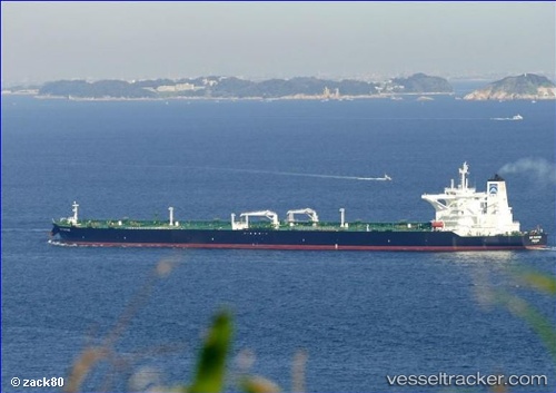
 DHT PANTHER
Current Status
Where is the vessel?
DHT PANTHER is currently in 18 nm S of HAMBANTOTA, based on AIS data received about 14h ago.
Latest AIS update:
Current position: 5.82935° N, 81.08024° E (18 nm S of HAMBANTOTA)
Average speed (last 7 days): Loading…
Average speed (last 30 days): Loading…
Vessel profile: DHT PANTHER is a Tanker with dimensions m x m.
This page combines live AIS, route history, probable destination signals, nearby traffic, and port activity for practical vessel monitoring.
The current position of vessel DHT PANTHER is 5.82935 lat / 81.08024 lng. Updated: 2026-05-21 01:25:58 UTCNearest reference points:
- Near HAMBANTOTA
- 15 nm S of Koggala
- 28 nm SW of Matara
Currently sailing under the flag of Marshall Islands ![]()
Details:
Live Vessel DHT PANTHER Analytics (details, animations, etc.)
Recent AIS points (UTC):
2026-05-20 22:17:51 UTC · 5.93500, 81.78833 · SOG 13 kn · COG -1°2026-05-20 22:35:51 UTC · 5.92333, 81.72167 · SOG 13 kn · COG -1°
2026-05-20 23:43:52 UTC · 5.87518, 81.46615 · SOG 14 kn · COG 261°
2026-05-21 01:25:58 UTC · 5.82935, 81.08024 · SOG 14.1 kn · COG 261°