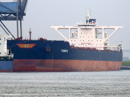
 TEMPO
TEMPO
Current Status
Where is the vessel?
TEMPO is currently in Near Port Headland, based on AIS data received about 16h ago.
Latest AIS update:
Current position: 20.32023° S, 118.56960° E (Near Port Headland)
Average speed (last 7 days): Loading…
Average speed (last 30 days): Loading…
Vessel profile: TEMPO is a Cargo with dimensions m x m.
This page combines live AIS, route history, probable destination signals, nearby traffic, and port activity for practical vessel monitoring.
The current position of vessel TEMPO is -20.32023 lat / 118.56960 lng. Updated: 2026-05-19 07:32:05 UTCNearest reference points:
- 11 nm E of Port Walcot
- 116 nm NE of Mutineer
Currently sailing under the flag of Marshall Islands ![]()
Details:
Live Vessel TEMPO Analytics (details, animations, etc.)
Recent AIS points (UTC):
2026-05-19 04:05:04 UTC · -20.32025, 118.56962 · SOG 0 kn · COG 358°2026-05-19 05:32:04 UTC · -20.32026, 118.56962 · SOG 0 kn · COG 358°
2026-05-19 07:23:09 UTC · -20.32027, 118.56963 · SOG 0 kn · COG 357°
2026-05-19 07:32:05 UTC · -20.32023, 118.56960 · SOG 0 kn · COG 358°