 MAGELLAN
Current Status
Where is the vessel?
MAGELLAN is currently in 41 nm N of Villanueva de Lorenzana, based on AIS data received about 14h ago.
Latest AIS update:
Current position: 44.09795° N, 9.62277° W (41 nm N of Villanueva de Lorenzana)
Average speed (last 7 days): Loading…
Average speed (last 30 days): Loading…
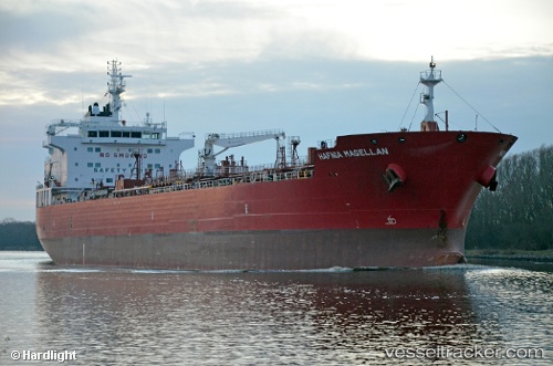
Vessel profile: MAGELLAN is a Tanker with dimensions m x m.
This page combines live AIS, route history, probable destination signals, nearby traffic, and port activity for practical vessel monitoring.
The current position of vessel MAGELLAN is 44.09795 lat / -9.62277 lng. Updated: 2026-05-19 07:51:48 UTCNearest reference points:
- 13 nm NE of Villanueva de Lorenzana
- 30 nm NW of Meiras-Valdoviño
- Near PUNTA LANGOSTEIRA
Currently sailing under the flag of Marshall Islands ![]()
Details:
Live Vessel MAGELLAN Analytics (details, animations, etc.)
Recent AIS points (UTC):
2026-05-19 05:01:13 UTC · 44.55217, -9.24729 · SOG 10.8 kn · COG 219°2026-05-19 05:46:41 UTC · 44.43977, -9.35588 · SOG 10.7 kn · COG -1°
2026-05-19 07:31:00 UTC · 44.15669, -9.57907 · SOG 11.5 kn · COG -1°
2026-05-19 07:51:48 UTC · 44.09795, -9.62277 · SOG 11.4 kn · COG 211°