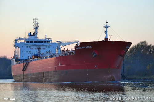
 MALACCA
Current Status
Where is the vessel?
MALACCA is currently in Near SARROCH, based on AIS data received about 14h ago.
Latest AIS update:
Current position: 39.08686° N, 9.03520° E (Near SARROCH)
Average speed (last 7 days): Loading…
Average speed (last 30 days): Loading…
Vessel profile: MALACCA is a Tanker with dimensions m x m.
This page combines live AIS, route history, probable destination signals, nearby traffic, and port activity for practical vessel monitoring.
The current position of vessel MALACCA is 39.08686 lat / 9.03520 lng. Updated: 2026-05-19 00:02:58 UTCNearest reference points:
- Near SARROCH
- Near Cagliari
- Near CARLOFORTE
Currently sailing under the flag of Marshall Islands ![]()
Details:
Live Vessel MALACCA Analytics (details, animations, etc.)
Recent AIS points (UTC):
2026-05-18 20:23:58 UTC · 39.08688, 9.03519 · SOG 0 kn · COG 318°2026-05-18 21:41:58 UTC · 39.08684, 9.03519 · SOG 0.1 kn · COG 318°
2026-05-18 22:56:58 UTC · 39.08685, 9.03519 · SOG 0 kn · COG 318°
2026-05-19 00:02:58 UTC · 39.08686, 9.03520 · SOG 0.1 kn · COG 318°