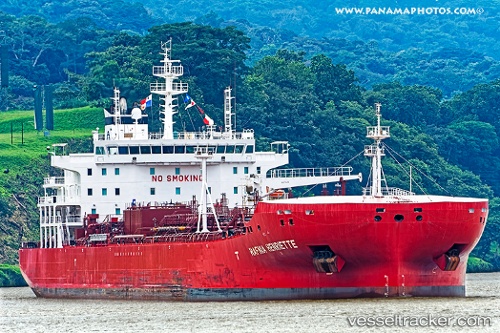
Hafnia Henriette
Current StatusWhere is the vessel?
Hafnia Henriette is currently in 54 nm S of Badau, based on AIS data received about 19h ago.
Latest AIS update:
Current position: 3.69280° S, 107.51626° E (54 nm S of Badau)
Average speed (last 7 days): Loading…
Average speed (last 30 days): Loading…
Vessel profile: Hafnia Henriette is a Chemical Oil Products Tanker with dimensions 32m x 183m.
This page combines live AIS, route history, probable destination signals, nearby traffic, and port activity for practical vessel monitoring.
The current position of vessel Hafnia Henriette is -3.69280 lat / 107.51626 lng. Updated: 2026-05-19 20:20:17 UTCNearest reference points:
- 96 nm E of Widuri
- 46 nm NW of Tanjung Pandan
- 53 nm NE of Tanjung Pandan
Details:
Live Vessel Hafnia Henriette Analytics (details, animations, etc.)
Recent AIS points (UTC):
2026-05-19 20:20:17 UTC · -3.69280, 107.51626 · SOG 12.1 kn · COG 175°2026-05-19 20:20:17 UTC · -3.69280, 107.51626 · SOG 12.1 kn · COG 175°
2026-05-19 20:20:17 UTC · -3.69280, 107.51626 · SOG 12.1 kn · COG 175°
2026-05-19 20:20:17 UTC · -3.69280, 107.51626 · SOG 12.1 kn · COG 175°