 DRIVE GREEN HIGHWAY
Current Status
Where is the vessel?
DRIVE GREEN HIGHWAY is currently in Open sea (no nearby ports in database), based on AIS data received about 14h ago.
Latest AIS update:
Current position: 7.75020° S, 3.31673° W (Open sea (no nearby ports in database))
Average speed (last 7 days): Loading…
Average speed (last 30 days): Loading…
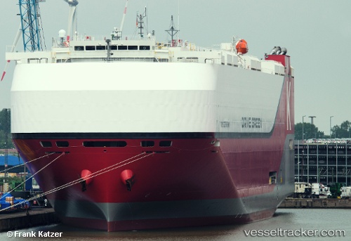
Vessel profile: DRIVE GREEN HIGHWAY is a Cargo with dimensions m x m.
This page combines live AIS, route history, probable destination signals, nearby traffic, and port activity for practical vessel monitoring.
The current position of vessel DRIVE GREEN HIGHWAY is -7.75020 lat / -3.31673 lng. Updated: 2026-05-21 07:58:19 UTCNearest reference points:
- Open sea (no nearby ports in database)
Currently sailing under the flag of Japan ![]()
Details:
Live Vessel DRIVE GREEN HIGHWAY Analytics (details, animations, etc.)
Recent AIS points (UTC):
2026-05-21 04:10:34 UTC · -8.63299, -2.64983 · SOG 17.4 kn · COG 326°2026-05-21 06:07:51 UTC · -8.17624, -2.99051 · SOG 17.5 kn · COG 323°
2026-05-21 07:04:02 UTC · -7.96173, -3.15750 · SOG 17.3 kn · COG 324°
2026-05-21 07:58:19 UTC · -7.75020, -3.31673 · SOG 17.4 kn · COG 324°