 Orion Highway
Current Status
Where is the vessel?
Orion Highway is currently in 372 nm N of Mutsamudu, Anjouan, based on AIS data received about 14h ago.
Latest AIS update:
Current position: 6.09241° S, 45.66611° E (372 nm N of Mutsamudu, Anjouan)
Average speed (last 7 days): Loading…
Average speed (last 30 days): Loading…
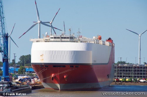
Vessel profile: Orion Highway is a Vehicles Carrier with dimensions 199m x 37m.
This page combines live AIS, route history, probable destination signals, nearby traffic, and port activity for practical vessel monitoring.
The current position of vessel Orion Highway is -6.09241 lat / 45.66611 lng. Updated: 2026-05-19 17:54:33 UTCNearest reference points:
- Open sea, approx. 401 nm off the nearest listed port
- Open sea, approx. 404 nm off the nearest listed port
- Open sea, approx. 403 nm off the nearest listed port
Currently sailing under the flag of Panama ![]()
Details:
Live Vessel Orion Highway Analytics (details, animations, etc.)
Recent AIS points (UTC):
2026-05-19 14:10:17 UTC · -5.71237, 44.52800 · SOG 18.6 kn · COG 114°2026-05-19 15:43:09 UTC · -5.86713, 44.99288 · SOG 19.1 kn · COG 116°
2026-05-19 15:51:43 UTC · -5.88236, 45.03542 · SOG 19 kn · COG 114°
2026-05-19 17:54:33 UTC · -6.09241, 45.66611 · SOG 19.3 kn · COG 114°