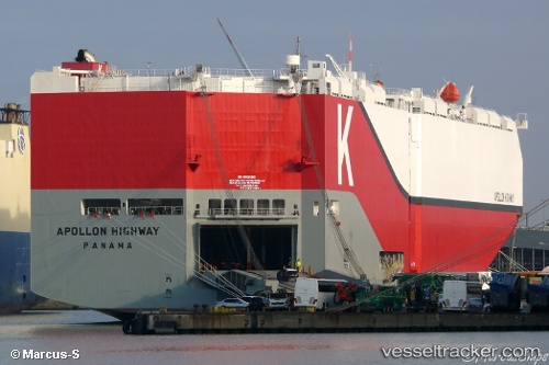
 Apollon Highway
Current Status
Where is the vessel?
Apollon Highway is currently in Near Lazaro Cardenas, based on AIS data received about 14h ago.
Latest AIS update:
Current position: 17.84306° N, 102.17656° W (Near Lazaro Cardenas)
Average speed (last 7 days): Loading…
Average speed (last 30 days): Loading…
Vessel profile: Apollon Highway is a Vehicles Carrier with dimensions 200m x 40m.
This page combines live AIS, route history, probable destination signals, nearby traffic, and port activity for practical vessel monitoring.
The current position of vessel Apollon Highway is 17.84306 lat / -102.17656 lng. Updated: 2026-05-20 10:05:01 UTCNearest reference points:
- Near Lazaro Cardenas
- Near Ixtapa/Zihuatanejo
- 43 nm SW of Antunez
Currently sailing under the flag of Panama ![]()
Details:
Live Vessel Apollon Highway Analytics (details, animations, etc.)
Recent AIS points (UTC):
2026-05-20 06:12:30 UTC · 17.82607, -102.61551 · SOG 7.8 kn · COG 90°2026-05-20 08:03:30 UTC · 17.82428, -102.37041 · SOG 6.9 kn · COG 85°
2026-05-20 08:10:51 UTC · 17.82474, -102.35703 · SOG 5.9 kn · COG 85°
2026-05-20 10:05:01 UTC · 17.84306, -102.17656 · SOG 5.4 kn · COG 66°