 Polaris Highway
Current Status
Where is the vessel?
Polaris Highway is currently in 47 nm SW of Puerto Jimenez, based on AIS data received about 14h ago.
Latest AIS update:
Current position: 8.07528° N, 83.96042° W (47 nm SW of Puerto Jimenez)
Average speed (last 7 days): Loading…
Average speed (last 30 days): Loading…
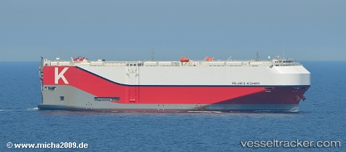
Vessel profile: Polaris Highway is a Vehicles Carrier with dimensions 199m x 38m.
This page combines live AIS, route history, probable destination signals, nearby traffic, and port activity for practical vessel monitoring.
The current position of vessel Polaris Highway is 8.07528 lat / -83.96042 lng. Updated: 2026-05-18 22:40:04 UTCNearest reference points:
- Near Chiriquí Grande
- 67 nm SW of Sámara
- 27 nm W of Playa Conchal
Currently sailing under the flag of Panama ![]()
Details:
Live Vessel Polaris Highway Analytics (details, animations, etc.)
Recent AIS points (UTC):
2026-05-18 19:32:11 UTC · 8.49426, -84.68307 · SOG 16.1 kn · COG 122°2026-05-18 19:55:14 UTC · 8.44023, -84.59494 · SOG 16.1 kn · COG 122°
2026-05-18 21:56:46 UTC · 8.16687, -84.12464 · SOG 15.7 kn · COG 118°
2026-05-18 22:40:04 UTC · 8.07528, -83.96042 · SOG 15.6 kn · COG 119°