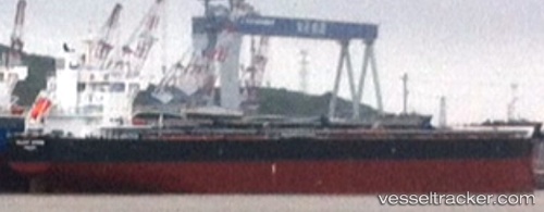
 VELA
VELA
Current Status
Where is the vessel?
VELA is currently in Near Cubatao, based on AIS data received about 14h ago.
Latest AIS update:
Current position: 23.88086° S, 46.37441° W (Near Cubatao)
Average speed (last 7 days): Loading…
Average speed (last 30 days): Loading…
Vessel profile: VELA is a Cargo with dimensions m x m.
This page combines live AIS, route history, probable destination signals, nearby traffic, and port activity for practical vessel monitoring.
The current position of vessel VELA is -23.88086 lat / -46.37441 lng. Updated: 2026-05-19 14:05:53 UTCNearest reference points:
- Near Santos
- Near Guarujá
- 30 nm SE of Guarujá
Currently sailing under the flag of Marshall Islands ![]()
Details:
Live Vessel VELA Analytics (details, animations, etc.)
Recent AIS points (UTC):
2026-05-19 10:47:47 UTC · -23.88087, -46.37444 · SOG 0 kn · COG 354°2026-05-19 11:29:50 UTC · -23.88083, -46.37440 · SOG 0 kn · COG 354°
2026-05-19 13:59:50 UTC · -23.88086, -46.37443 · SOG 0 kn · COG 354°
2026-05-19 14:05:53 UTC · -23.88086, -46.37441 · SOG 0 kn · COG 354°