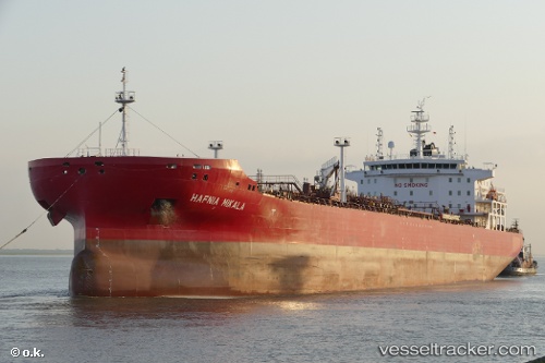
Hafnia Mikala
Current StatusWhere is the vessel?
Hafnia Mikala is currently in 220 nm SW of Lukunor Atoll, based on AIS data received about 15h ago.
Latest AIS update:
Current position: 2.44549° N, 151.76460° E (220 nm SW of Lukunor Atoll)
Average speed (last 7 days): Loading…
Average speed (last 30 days): Loading…
Vessel profile: Hafnia Mikala is a Chemical Oil Products Tanker with dimensions 32m x 183m.
This page combines live AIS, route history, probable destination signals, nearby traffic, and port activity for practical vessel monitoring.
The current position of vessel Hafnia Mikala is 2.44549 lat / 151.76460 lng. Updated: 2026-05-20 22:06:23 UTCCurrently sailing under the flag of
Hafnia Mikala built in 0 year
Deadweight:
0 tDetails:
Live Vessel Hafnia Mikala Analytics (details, animations, etc.)
Recent AIS points (UTC):
2026-05-20 16:06:24 UTC · 3.21049, 150.68752 · SOG 12.8 kn · COG 127°2026-05-20 17:54:45 UTC · 2.97725, 151.00734 · SOG 12.8 kn · COG 126°
2026-05-20 21:42:26 UTC · 2.49599, 151.69200 · SOG 13.4 kn · COG 127°
2026-05-20 22:06:23 UTC · 2.44549, 151.76460 · SOG 13.3 kn · COG 128°