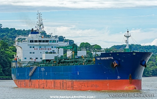
Trf Marquette
Current StatusWhere is the vessel?
Trf Marquette is currently in 109 nm SE of Port Saint John's, based on AIS data received about 14h ago.
Latest AIS update:
Current position: 32.86667° S, 31.10333° E (109 nm SE of Port Saint John's)
Average speed (last 7 days): Loading…
Average speed (last 30 days): Loading…
Vessel profile: Trf Marquette is a Chemical Oil Products Tanker with dimensions 27m x 184m.
This page combines live AIS, route history, probable destination signals, nearby traffic, and port activity for practical vessel monitoring.
The current position of vessel Trf Marquette is -32.86667 lat / 31.10333 lng. Updated: 2026-05-19 20:09:14 UTCNearest reference points:
- 125 nm SE of Port Edward
- 23 nm E of Port Saint John's
Details:
Live Vessel Trf Marquette Analytics (details, animations, etc.)
Recent AIS points (UTC):
2026-05-19 16:41:10 UTC · -32.62128, 31.84638 · SOG 10.8 kn · COG 254°2026-05-19 17:24:13 UTC · -32.66500, 31.68833 · SOG 11 kn · COG -1°
2026-05-19 19:26:55 UTC · -32.81650, 31.26198 · SOG 11.9 kn · COG 247°
2026-05-19 20:09:14 UTC · -32.86667, 31.10333 · SOG 12 kn · COG -1°