 vesseltracker.com
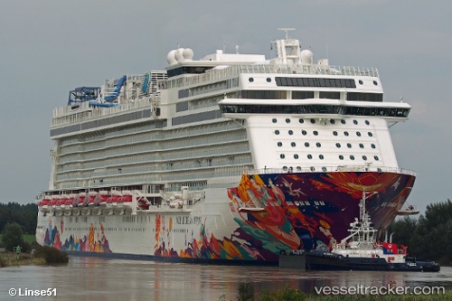
 AROYA
AROYA
Current Status
Where is the vessel?
AROYA is currently in 69 nm W of Umm Lajj, based on AIS data received about 14h ago.
Latest AIS update:
Current position: 25.22977° N, 36.02352° E (69 nm W of Umm Lajj)
Average speed (last 7 days): Loading…
Average speed (last 30 days): Loading…
Vessel profile: AROYA is a Passenger with dimensions m x m.
This page combines live AIS, route history, probable destination signals, nearby traffic, and port activity for practical vessel monitoring.
The current position of vessel AROYA is 25.22977 lat / 36.02352 lng. Updated: 2026-05-18 14:09:46 UTCNearest reference points:
- 41 nm NW of Umm Lajj
- 35 nm S of Umm Lajj
- 74 nm SW of Yanbu
Currently sailing under the flag of Malta ![]()
Details:
Live Vessel AROYA Analytics (details, animations, etc.)
Recent AIS points (UTC):
2026-05-18 12:09:17 UTC · 24.84912, 36.27823 · SOG 13.1 kn · COG 324°2026-05-18 13:12:15 UTC · 25.04501, 36.14558 · SOG 13.2 kn · COG 329°
2026-05-18 13:31:26 UTC · 25.10546, 36.10572 · SOG 13.3 kn · COG 329°
2026-05-18 14:09:46 UTC · 25.22977, 36.02352 · SOG 13.7 kn · COG 330°