 vesseltracker.com
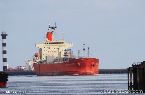
 GRANDE RIVIERE
Current Status
Where is the vessel?
GRANDE RIVIERE is currently in 10 nm NW of Diego Martin, based on AIS data received about 14h ago.
Latest AIS update:
Current position: 10.85773° N, 61.66497° W (10 nm NW of Diego Martin)
Average speed (last 7 days): Loading…
Average speed (last 30 days): Loading…
Vessel profile: GRANDE RIVIERE is a Tanker with dimensions m x m.
This page combines live AIS, route history, probable destination signals, nearby traffic, and port activity for practical vessel monitoring.
The current position of vessel GRANDE RIVIERE is 10.85773 lat / -61.66497 lng. Updated: 2026-05-18 07:44:49 UTCNearest reference points:
- Near CARENAGE
- Near Carenage
- Near Caroni
Currently sailing under the flag of Panama ![]()
Details:
Live Vessel GRANDE RIVIERE Analytics (details, animations, etc.)
Recent AIS points (UTC):
2026-05-18 04:00:29 UTC · 11.54083, -61.16138 · SOG 13 kn · COG 210°2026-05-18 04:46:21 UTC · 11.39600, -61.25524 · SOG 13.9 kn · COG 216°
2026-05-18 05:44:27 UTC · 11.22792, -61.39578 · SOG 13.4 kn · COG 216°
2026-05-18 07:44:49 UTC · 10.85773, -61.66497 · SOG 12.4 kn · COG 217°