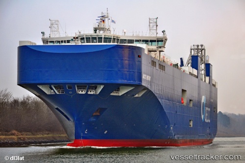
 Auto Energy
Current Status
Where is the vessel?
Auto Energy is currently in Near Land's End, based on AIS data received about 15h ago.
Latest AIS update:
Current position: 49.99188° N, 5.84962° W (Near Land's End)
Average speed (last 7 days): Loading…
Average speed (last 30 days): Loading…
Vessel profile: Auto Energy is a Vehicles Carrier with dimensions 181m x 32m.
This page combines live AIS, route history, probable destination signals, nearby traffic, and port activity for practical vessel monitoring.
The current position of vessel Auto Energy is 49.99188 lat / -5.84962 lng. Updated: 2026-05-20 01:56:04 UTCNearest reference points:
- Near Isles of Scilly
- 28 nm S of Porthgwarra
- 10 nm NW of Grampound
Currently sailing under the flag of Portugal ![]()
Details:
Live Vessel Auto Energy Analytics (details, animations, etc.)
Recent AIS points (UTC):
2026-05-19 23:05:59 UTC · 49.90458, -5.19369 · SOG 9.3 kn · COG 264°2026-05-20 00:10:45 UTC · 49.92788, -5.44710 · SOG 9 kn · COG 278°
2026-05-20 01:14:26 UTC · 49.96394, -5.69215 · SOG 9.3 kn · COG 278°
2026-05-20 01:56:04 UTC · 49.99188, -5.84962 · SOG 9.6 kn · COG 285°