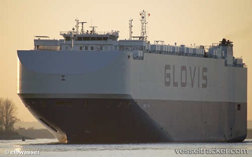
 Glovis Star
Current Status
Where is the vessel?
Glovis Star is currently in 89 nm N of NAKANOSHIMA, based on AIS data received about 15h ago.
Latest AIS update:
Current position: 37.49663° N, 133.74226° E (89 nm N of NAKANOSHIMA)
Average speed (last 7 days): Loading…
Average speed (last 30 days): Loading…
Vessel profile: Glovis Star is a Vehicles Carrier with dimensions 200m x 36m.
This page combines live AIS, route history, probable destination signals, nearby traffic, and port activity for practical vessel monitoring.
The current position of vessel Glovis Star is 37.49663 lat / 133.74226 lng. Updated: 2026-05-18 20:19:05 UTCNearest reference points:
- 82 nm NE of Dokdo
- 80 nm NE of Dokdo
- 37 nm NW of NAKANOSHIMA
Currently sailing under the flag of Bahamas ![]()
Details:
Live Vessel Glovis Star Analytics (details, animations, etc.)
Recent AIS points (UTC):
2026-05-18 17:09:06 UTC · 37.92729, 134.45116 · SOG 13.6 kn · COG 233°2026-05-18 17:54:18 UTC · 37.82911, 134.27817 · SOG 13.3 kn · COG 231°
2026-05-18 19:54:06 UTC · 37.55503, 133.83588 · SOG 13.6 kn · COG 230°
2026-05-18 20:19:05 UTC · 37.49663, 133.74226 · SOG 13.6 kn · COG 230°