 Evmar
Evmar
Current Status
Where is the vessel?
Evmar is currently in Near Neah Bay, based on AIS data received about 14h ago.
Latest AIS update:
Current position: 48.40624° N, 124.49657° W (Near Neah Bay)
Average speed (last 7 days): Loading…
Average speed (last 30 days): Loading…
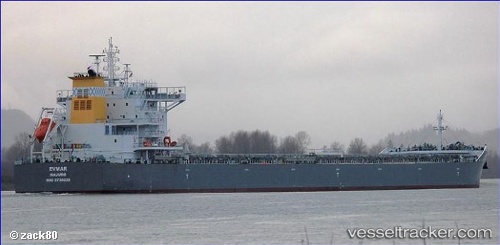
Vessel profile: Evmar is a Bulk Carrier with dimensions 229m x 32m.
This page combines live AIS, route history, probable destination signals, nearby traffic, and port activity for practical vessel monitoring.
The current position of vessel Evmar is 48.40624 lat / -124.49657 lng. Updated: 2026-05-20 14:22:34 UTCNearest reference points:
- Near Clallam Bay
- 21 nm NW of Tatoosh Island
- Near Cassidy
Currently sailing under the flag of Marshall Is ![]()
Details:
Live Vessel Evmar Analytics (details, animations, etc.)
Recent AIS points (UTC):
2026-05-20 10:57:45 UTC · 48.47424, -125.37200 · SOG 11.8 kn · COG 83°2026-05-20 11:58:46 UTC · 48.47828, -125.07872 · SOG 11.4 kn · COG 93°
2026-05-20 14:03:36 UTC · 48.42739, -124.56461 · SOG 9.8 kn · COG 114°
2026-05-20 14:22:34 UTC · 48.40624, -124.49657 · SOG 9.4 kn · COG 113°