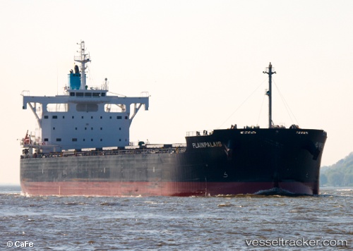
 PLAINPALAIS
Current Status
Where is the vessel?
PLAINPALAIS is currently in 156 nm SE of Belmonte, based on AIS data received about 15h ago.
Latest AIS update:
Current position: 17.07242° S, 36.51154° W (156 nm SE of Belmonte)
Average speed (last 7 days): Loading…
Average speed (last 30 days): Loading…
Vessel profile: PLAINPALAIS is a Cargo with dimensions m x m.
This page combines live AIS, route history, probable destination signals, nearby traffic, and port activity for practical vessel monitoring.
The current position of vessel PLAINPALAIS is -17.07242 lat / -36.51154 lng. Updated: 2026-05-22 03:19:59 UTCNearest reference points:
- 169 nm E of Alcobaca
- 91 nm E of Conceicao da Barra
Currently sailing under the flag of Marshall Islands ![]()
Details:
Live Vessel PLAINPALAIS Analytics (details, animations, etc.)
Recent AIS points (UTC):
2026-05-21 22:33:54 UTC · -17.96181, -36.81754 · SOG 11.4 kn · COG 20°2026-05-22 02:03:23 UTC · -17.30902, -36.59025 · SOG 11.7 kn · COG 15°
2026-05-22 03:19:59 UTC · -17.07242, -36.51154 · SOG 11.8 kn · COG -1°
2026-05-22 03:19:59 UTC · -17.07242, -36.51154 · SOG 11.8 kn · COG -1°