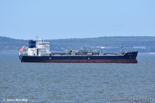
Palanca Rio
Current StatusWhere is the vessel?
Palanca Rio is currently in 21 nm N of North Truro, based on AIS data received about 15h ago.
Latest AIS update:
Current position: 42.37740° N, 70.04812° W (21 nm N of North Truro)
Average speed (last 7 days): Loading…
Average speed (last 30 days): Loading…
Vessel profile: Palanca Rio is a Bitumen Tanker with dimensions 23m x 133m.
This page combines live AIS, route history, probable destination signals, nearby traffic, and port activity for practical vessel monitoring.
The current position of vessel Palanca Rio is 42.37740 lat / -70.04812 lng. Updated: 2026-05-20 14:00:08 UTCNearest reference points:
- 30 nm E of York Beach
- Near Cohasset
- Near Barnstable
Details:
Live Vessel Palanca Rio Analytics (details, animations, etc.)
Recent AIS points (UTC):
2026-05-20 10:41:17 UTC · 41.83882, -69.67188 · SOG 8.6 kn · COG 332°2026-05-20 12:29:28 UTC · 42.11587, -69.85860 · SOG 12.2 kn · COG 332°
2026-05-20 13:19:17 UTC · 42.26310, -69.95418 · SOG 12 kn · COG 333°
2026-05-20 14:00:08 UTC · 42.37740, -70.04812 · SOG 11.9 kn · COG 323°