 vesseltracker.com
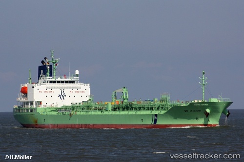
 RADIANT RAY
Current Status
Where is the vessel?
RADIANT RAY is currently in 38 nm W of Keti Bandar, based on AIS data received about 14h ago.
Latest AIS update:
Current position: 24.02426° N, 66.75052° E (38 nm W of Keti Bandar)
Average speed (last 7 days): Loading…
Average speed (last 30 days): Loading…
Vessel profile: RADIANT RAY is a Chemical/Oil Products Tanker with dimensions 147m x 24m.
This page combines live AIS, route history, probable destination signals, nearby traffic, and port activity for practical vessel monitoring.
The current position of vessel RADIANT RAY is 24.02426 lat / 66.75052 lng. Updated: 2026-05-18 05:56:04 UTCNearest reference points:
- 16 nm S of Kiamari
- Near Kiamari
- 84 nm SW of Keti Bandar
Currently sailing under the flag of Liberia ![]()
RADIANT RAY built in 2018 year
Deadweight:
19974 tDetails:
Live Vessel RADIANT RAY Analytics (details, animations, etc.)
Recent AIS points (UTC):
2026-05-18 01:54:53 UTC · 23.84450, 66.89191 · SOG 8.2 kn · COG 314°2026-05-18 04:08:16 UTC · 24.02475, 66.70030 · SOG 1.2 kn · COG 305°
2026-05-18 04:14:53 UTC · 24.02435, 66.70297 · SOG 1.3 kn · COG 344°
2026-05-18 05:56:04 UTC · 24.02426, 66.75052 · SOG 1.4 kn · COG 338°