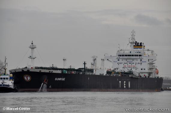
 Sunrise
Current Status
Where is the vessel?
Sunrise is currently in 236 nm SW of Lahat, based on AIS data received about 15h ago.
Latest AIS update:
Current position: 6.92546° S, 101.14187° E (236 nm SW of Lahat)
Average speed (last 7 days): Loading…
Average speed (last 30 days): Loading…
Vessel profile: Sunrise is a Crude Oil Tanker with dimensions 228m x 32m.
This page combines live AIS, route history, probable destination signals, nearby traffic, and port activity for practical vessel monitoring.
The current position of vessel Sunrise is -6.92546 lat / 101.14187 lng. Updated: 2026-05-19 15:10:21 UTCNearest reference points:
- 293 nm SW of Lahat
- 163 nm W of Panjang
- 67 nm S of Lahat
Currently sailing under the flag of Liberia ![]()
Details:
Live Vessel Sunrise Analytics (details, animations, etc.)
Recent AIS points (UTC):
2026-05-19 11:05:30 UTC · -6.71104, 102.02177 · SOG 13.2 kn · COG 257°2026-05-19 12:23:47 UTC · -6.78045, 101.74047 · SOG 13.3 kn · COG 255°
2026-05-19 13:16:07 UTC · -6.82856, 101.55291 · SOG 13.2 kn · COG 255°
2026-05-19 15:10:21 UTC · -6.92546, 101.14187 · SOG 13 kn · COG 254°