 American Liberty
Current Status
Where is the vessel?
American Liberty is currently in 219 nm SE of Port Eads, based on AIS data received about 15h ago.
Latest AIS update:
Current position: 25.88500° N, 87.04500° W (219 nm SE of Port Eads)
Average speed (last 7 days): Loading…
Average speed (last 30 days): Loading…
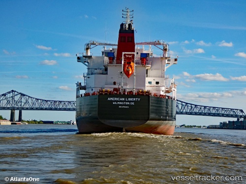
Vessel profile: American Liberty is a Chemical Oil Products Tanker with dimensions 183m x 32m.
This page combines live AIS, route history, probable destination signals, nearby traffic, and port activity for practical vessel monitoring.
The current position of vessel American Liberty is 25.88500 lat / -87.04500 lng. Updated: 2026-05-18 17:31:31 UTCCurrently sailing under the flag of USA ![]()
Details:
Live Vessel American Liberty Analytics (details, animations, etc.)
Recent AIS points (UTC):
2026-05-18 13:43:32 UTC · 25.54667, -86.20167 · SOG 12 kn · COG -1°2026-05-18 15:34:34 UTC · 25.71333, -86.59500 · SOG 13 kn · COG -1°
2026-05-18 16:40:32 UTC · 25.81500, -86.84333 · SOG 13 kn · COG -1°
2026-05-18 17:31:31 UTC · 25.88500, -87.04500 · SOG 13 kn · COG -1°