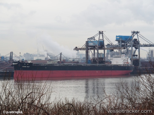
 Rong May
Current Status
Where is the vessel?
Rong May is currently in 121 nm N of Ilha do Sal, based on AIS data received about 15h ago.
Latest AIS update:
Current position: 18.69734° N, 23.46987° W (121 nm N of Ilha do Sal)
Average speed (last 7 days): Loading…
Average speed (last 30 days): Loading…
Vessel profile: Rong May is a Bulk Carrier with dimensions 228m x 36m.
This page combines live AIS, route history, probable destination signals, nearby traffic, and port activity for practical vessel monitoring.
The current position of vessel Rong May is 18.69734 lat / -23.46987 lng. Updated: 2026-05-20 08:13:03 UTCNearest reference points:
- 61 nm NW of Ilha do Sal
- 129 nm N of Mindelo
- 102 nm N of Porto Grande
Currently sailing under the flag of Liberia ![]()
Details:
Live Vessel Rong May Analytics (details, animations, etc.)
Recent AIS points (UTC):
2026-05-20 04:17:00 UTC · 18.25767, -23.85628 · SOG 9 kn · COG 38°2026-05-20 05:48:20 UTC · 18.42848, -23.70639 · SOG 8.7 kn · COG 40°
2026-05-20 07:19:12 UTC · 18.59601, -23.55894 · SOG 8.9 kn · COG 40°
2026-05-20 08:13:03 UTC · 18.69734, -23.46987 · SOG 8.9 kn · COG 42°