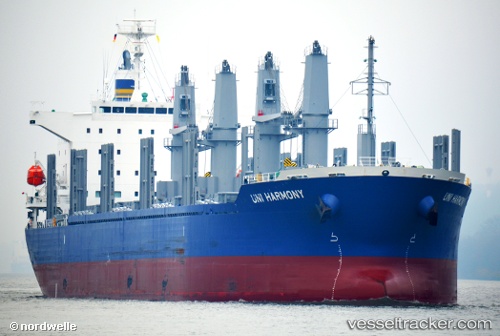
Uni Harmony
Current StatusWhere is the vessel?
Uni Harmony is currently in 16 nm N of Abulug, based on AIS data received about 14h ago.
Latest AIS update:
Current position: 18.69333° N, 121.51368° E (16 nm N of Abulug)
Average speed (last 7 days): Loading…
Average speed (last 30 days): Loading…
Vessel profile: Uni Harmony is a Bulk Carrier with dimensions 30m x 180m.
This page combines live AIS, route history, probable destination signals, nearby traffic, and port activity for practical vessel monitoring.
The current position of vessel Uni Harmony is 18.69333 lat / 121.51368 lng. Updated: 2026-05-22 10:13:50 UTCNearest reference points:
- 66 nm W of Basco
- 55 nm SE of Port Irene
- 22 nm W of Salomague
Details:
Live Vessel Uni Harmony Analytics (details, animations, etc.)
Recent AIS points (UTC):
2026-05-22 07:21:15 UTC · 18.74415, 120.82543 · SOG 11.9 kn · COG 90°2026-05-22 08:19:25 UTC · 18.73062, 121.04745 · SOG 13.5 kn · COG 98°
2026-05-22 09:29:30 UTC · 18.70694, 121.33385 · SOG 14 kn · COG 91°
2026-05-22 10:13:50 UTC · 18.69333, 121.51368 · SOG 13.5 kn · COG -1°