 vesseltracker.com
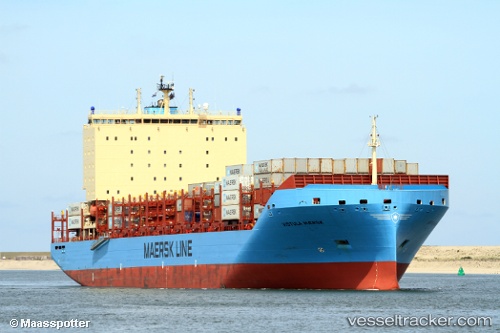
 Vistula Maersk
Current Status
Where is the vessel?
Vistula Maersk is currently in 61 nm E of Chapineria, based on AIS data received about 14h ago.
Latest AIS update:
Current position: 40.47500° N, 40.01333° W (61 nm E of Chapineria)
Average speed (last 7 days): Loading…
Average speed (last 30 days): Loading…
Vessel profile: Vistula Maersk is a Container Ship with dimensions 200m x 36m.
This page combines live AIS, route history, probable destination signals, nearby traffic, and port activity for practical vessel monitoring.
The current position of vessel Vistula Maersk is 40.47500 lat / -40.01333 lng. Updated: 2026-05-18 01:52:56 UTCNearest reference points:
- 97 nm SE of Chapineria
Currently sailing under the flag of Denmark ![]()
Details:
Live Vessel Vistula Maersk Analytics (details, animations, etc.)
Recent AIS points (UTC):
2026-05-17 22:25:23 UTC · 40.39333, -38.84500 · SOG 16 kn · COG -1°2026-05-18 00:01:35 UTC · 40.43167, -39.39167 · SOG 15 kn · COG -1°
2026-05-18 00:52:47 UTC · 40.45167, -39.68167 · SOG 16 kn · COG -1°
2026-05-18 01:52:56 UTC · 40.47500, -40.01333 · SOG 15 kn · COG -1°