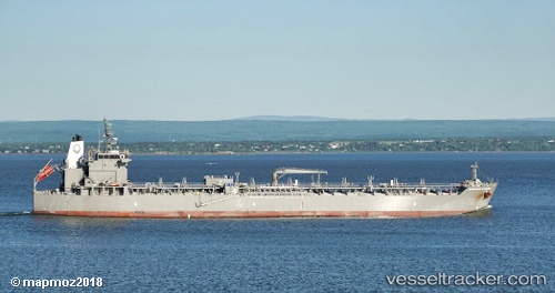
 SL HAWAII
Current Status
Where is the vessel?
SL HAWAII is currently in Near Sasebo, based on AIS data received about 15h ago.
Latest AIS update:
Current position: 33.08472° N, 129.71529° E (Near Sasebo)
Average speed (last 7 days): Loading…
Average speed (last 30 days): Loading…
Vessel profile: SL HAWAII is a Tanker with dimensions m x m.
This page combines live AIS, route history, probable destination signals, nearby traffic, and port activity for practical vessel monitoring.
The current position of vessel SL HAWAII is 33.08472 lat / 129.71529 lng. Updated: 2026-05-20 19:04:39 UTCNearest reference points:
- Near MATSUSHIMA
- Near TSUKINOKAWA
- Near Fukushima, Nagasaki
Currently sailing under the flag of United States ![]()
Details:
Live Vessel SL HAWAII Analytics (details, animations, etc.)
Recent AIS points (UTC):
2026-05-20 15:49:39 UTC · 33.08475, 129.71526 · SOG 0 kn · COG 309°2026-05-20 17:04:39 UTC · 33.08472, 129.71526 · SOG 0 kn · COG 309°
2026-05-20 18:19:39 UTC · 33.08477, 129.71523 · SOG 0 kn · COG 309°
2026-05-20 19:04:39 UTC · 33.08472, 129.71529 · SOG 0 kn · COG 309°