 MELIA
MELIA
Current Status
Where is the vessel?
MELIA is currently in 20 nm SE of Shima, Mie, based on AIS data received about 14h ago.
Latest AIS update:
Current position: 34.17664° N, 137.18585° E (20 nm SE of Shima, Mie)
Average speed (last 7 days): Loading…
Average speed (last 30 days): Loading…
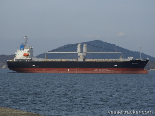
Vessel profile: MELIA is a Cargo with dimensions m x m.
This page combines live AIS, route history, probable destination signals, nearby traffic, and port activity for practical vessel monitoring.
The current position of vessel MELIA is 34.17664 lat / 137.18585 lng. Updated: 2026-05-21 19:22:34 UTCNearest reference points:
- 12 nm E of TOBA
- 17 nm S of TOYOHASHI
- 20 nm S of HAMAJIMA
Currently sailing under the flag of Philippines ![]()
Details:
Live Vessel MELIA Analytics (details, animations, etc.)
Recent AIS points (UTC):
2026-05-21 15:58:55 UTC · 34.14722, 137.17838 · SOG 0.3 kn · COG 293°2026-05-21 17:08:03 UTC · 34.15884, 137.18011 · SOG 0.5 kn · COG 287°
2026-05-21 18:22:24 UTC · 34.16980, 137.18266 · SOG 0.8 kn · COG 287°
2026-05-21 19:22:34 UTC · 34.17664, 137.18585 · SOG 0.1 kn · COG 303°