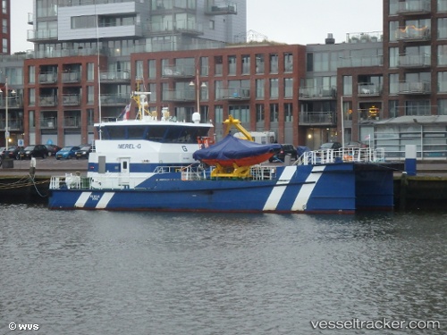
 MEREL G
Current Status
Where is the vessel?
MEREL G is currently in 11 nm NE of SASSNITZ, based on AIS data received about 14h ago.
Latest AIS update:
Current position: 54.67390° N, 13.80289° E (11 nm NE of SASSNITZ)
Average speed (last 7 days): Loading…
Average speed (last 30 days): Loading…
Vessel profile: MEREL G is a Other Type with dimensions m x m.
This page combines live AIS, route history, probable destination signals, nearby traffic, and port activity for practical vessel monitoring.
The current position of vessel MEREL G is 54.67390 lat / 13.80289 lng. Updated: 2026-05-20 04:43:09 UTCNearest reference points:
- Near SASSNITZ
- Near Baabe (Ostseebad)
- Near Lietzow
Details:
Live Vessel MEREL G Analytics (details, animations, etc.)
Recent AIS points (UTC):
2026-05-20 01:07:31 UTC · 54.75347, 13.85148 · SOG 0.5 kn · COG 218°2026-05-20 02:07:42 UTC · 54.73205, 13.88202 · SOG 0.7 kn · COG 67°
2026-05-20 04:08:31 UTC · 54.74348, 13.85289 · SOG 0.7 kn · COG 24°
2026-05-20 04:43:09 UTC · 54.67390, 13.80289 · SOG 9.6 kn · COG 199°