 vesseltracker.com
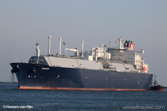
Kinisis
Current StatusWhere is the vessel?
Kinisis is currently in 35 nm NE of Spanish Wells, based on AIS data received about 15h ago.
Latest AIS update:
Current position: 26.05827° N, 76.44419° W (35 nm NE of Spanish Wells)
Average speed (last 7 days): Loading…
Average speed (last 30 days): Loading…
Vessel profile: Kinisis is a Lng Tanker with dimensions 46m x 295m.
This page combines live AIS, route history, probable destination signals, nearby traffic, and port activity for practical vessel monitoring.
The current position of vessel Kinisis is 26.05827 lat / -76.44419 lng. Updated: 2026-05-18 11:42:44 UTCNearest reference points:
- 22 nm E of Harbour Island
- Near Harbour Island
- 31 nm E of Harbour Island
Details:
Live Vessel Kinisis Analytics (details, animations, etc.)
Recent AIS points (UTC):
2026-05-18 08:16:52 UTC · 26.06644, -76.39933 · SOG 7.1 kn · COG 110°2026-05-18 09:39:40 UTC · 26.04010, -76.37819 · SOG 1.6 kn · COG 168°
2026-05-18 11:02:13 UTC · 26.04669, -76.42236 · SOG 1.9 kn · COG 183°
2026-05-18 11:42:44 UTC · 26.05827, -76.44419 · SOG 2 kn · COG 183°