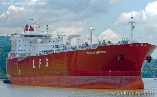
 Clipper Freeport
Current Status
Where is the vessel?
Clipper Freeport is currently in 83 nm SE of Malokurilskoe, based on AIS data received about 15h ago.
Latest AIS update:
Current position: 43.14702° N, 148.43674° E (83 nm SE of Malokurilskoe)
Average speed (last 7 days): Loading…
Average speed (last 30 days): Loading…
Vessel profile: Clipper Freeport is a Lpg Tanker with dimensions 230m x 32m.
This page combines live AIS, route history, probable destination signals, nearby traffic, and port activity for practical vessel monitoring.
The current position of vessel Clipper Freeport is 43.14702 lat / 148.43674 lng. Updated: 2026-05-20 17:56:27 UTCNearest reference points:
- 27 nm SE of Tomari
- Near Yuzhno-Kuril'sk
Currently sailing under the flag of Norway ![]()
Details:
Live Vessel Clipper Freeport Analytics (details, animations, etc.)
Recent AIS points (UTC):
2026-05-20 13:59:38 UTC · 42.76667, 147.13333 · SOG 15 kn · COG -1°2026-05-20 15:25:37 UTC · 42.90974, 147.60669 · SOG 15.7 kn · COG 67°
2026-05-20 15:53:34 UTC · 42.95260, 147.76089 · SOG 15.6 kn · COG 67°
2026-05-20 17:56:27 UTC · 43.14702, 148.43674 · SOG 15.4 kn · COG 67°