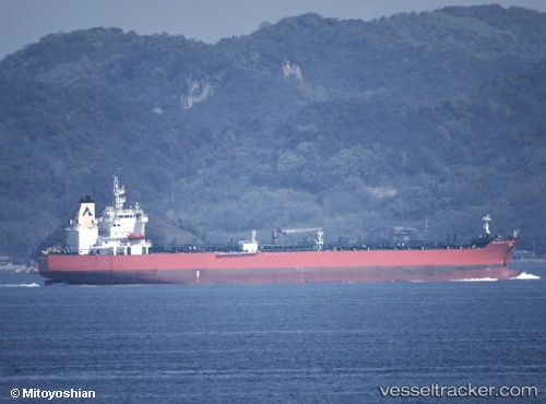
Atlantic Harmony
Current StatusWhere is the vessel?
Atlantic Harmony is currently in 65 nm SW of Balvi, based on AIS data received about 14h ago.
Latest AIS update:
Current position: 56.50599° N, 28.85259° W (65 nm SW of Balvi)
Average speed (last 7 days): Loading…
Average speed (last 30 days): Loading…
Vessel profile: Atlantic Harmony is a Chemical Oil Products Tanker with dimensions 32m x 183m.
This page combines live AIS, route history, probable destination signals, nearby traffic, and port activity for practical vessel monitoring.
The current position of vessel Atlantic Harmony is 56.50599 lat / -28.85259 lng. Updated: 2026-05-20 04:22:25 UTCDetails:
Live Vessel Atlantic Harmony Analytics (details, animations, etc.)
Recent AIS points (UTC):
2026-05-20 01:53:16 UTC · 56.79848, -28.06764 · SOG 12.3 kn · COG 233°2026-05-20 01:53:16 UTC · 56.79848, -28.06764 · SOG 12.3 kn · COG 233°
2026-05-20 03:53:18 UTC · 56.56442, -28.69768 · SOG 12.7 kn · COG 233°
2026-05-20 04:22:25 UTC · 56.50599, -28.85259 · SOG 12.8 kn · COG 233°