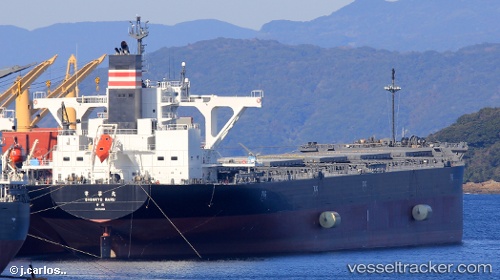
Shinryo Maru
Current StatusWhere is the vessel?
Shinryo Maru is currently in 85 nm E of Port Irene, based on AIS data received about 15h ago.
Latest AIS update:
Current position: 18.11333° N, 123.57500° E (85 nm E of Port Irene)
Average speed (last 7 days): Loading…
Average speed (last 30 days): Loading…
Vessel profile: Shinryo Maru is a Bulk Carrier with dimensions 43m x 235m.
This page combines live AIS, route history, probable destination signals, nearby traffic, and port activity for practical vessel monitoring.
The current position of vessel Shinryo Maru is 18.11333 lat / 123.57500 lng. Updated: 2026-05-21 15:45:51 UTCNearest reference points:
- 88 nm E of Port Irene
- 55 nm SE of Port Irene
Details:
Live Vessel Shinryo Maru Analytics (details, animations, etc.)
Recent AIS points (UTC):
2026-05-21 11:39:52 UTC · 17.50667, 124.12667 · SOG 11 kn · COG -1°2026-05-21 13:18:52 UTC · 17.74500, 123.91667 · SOG 11 kn · COG -1°
2026-05-21 14:03:50 UTC · 17.85500, 123.81500 · SOG 11 kn · COG -1°
2026-05-21 15:45:51 UTC · 18.11333, 123.57500 · SOG 12 kn · COG -1°