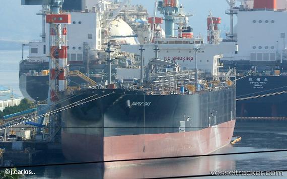
Maple Gas
Current StatusWhere is the vessel?
Maple Gas is currently in 269 nm NE of Port Mathurin, based on AIS data received about 14h ago.
Latest AIS update:
Current position: 17.51076° S, 67.54312° E (269 nm NE of Port Mathurin)
Average speed (last 7 days): Loading…
Average speed (last 30 days): Loading…
Vessel profile: Maple Gas is a Lpg Tanker with dimensions 37m x 230m.
This page combines live AIS, route history, probable destination signals, nearby traffic, and port activity for practical vessel monitoring.
The current position of vessel Maple Gas is -17.51076 lat / 67.54312 lng. Updated: 2026-05-20 03:24:51 UTCNearest reference points:
- 255 nm E of Rodrigues
- Open sea, approx. 401 nm off the nearest listed port
- Open sea, approx. 400 nm off the nearest listed port
Details:
Live Vessel Maple Gas Analytics (details, animations, etc.)
Recent AIS points (UTC):
2026-05-19 23:33:24 UTC · -16.94427, 68.47722 · SOG 16.3 kn · COG 235°2026-05-20 00:58:03 UTC · -17.14873, 68.13905 · SOG 16.4 kn · COG 236°
2026-05-20 02:08:28 UTC · -17.32408, 67.85335 · SOG 16.8 kn · COG 236°
2026-05-20 03:24:51 UTC · -17.51076, 67.54312 · SOG 16.1 kn · COG 235°