 vesseltracker.com
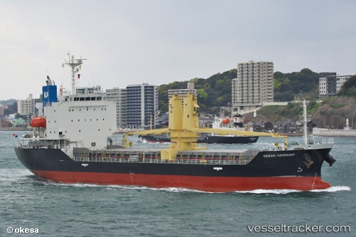
 Ocean Harmony
Current Status
Where is the vessel?
Ocean Harmony is currently in 29 nm SE of Minachi, based on AIS data received about 14h ago.
Latest AIS update:
Current position: 33.49008° N, 136.16739° E (29 nm SE of Minachi)
Average speed (last 7 days): Loading…
Average speed (last 30 days): Loading…
Vessel profile: Ocean Harmony is a General Cargo Ship with dimensions 100m x 19m.
This page combines live AIS, route history, probable destination signals, nearby traffic, and port activity for practical vessel monitoring.
The current position of vessel Ocean Harmony is 33.49008 lat / 136.16739 lng. Updated: 2026-05-17 21:31:54 UTCNearest reference points:
- 23 nm S of Minachi
- 20 nm S of HAMAJIMA
- 40 nm SW of Minachi
Currently sailing under the flag of Panama ![]()
Details:
Live Vessel Ocean Harmony Analytics (details, animations, etc.)
Recent AIS points (UTC):
2026-05-17 18:01:55 UTC · 33.52328, 136.22211 · SOG 0.9 kn · COG 220°2026-05-17 20:02:05 UTC · 33.49978, 136.19328 · SOG 1.2 kn · COG 251°
2026-05-17 20:16:46 UTC · 33.49721, 136.18854 · SOG 1.2 kn · COG 257°
2026-05-17 21:31:54 UTC · 33.49008, 136.16739 · SOG 0.7 kn · COG 289°