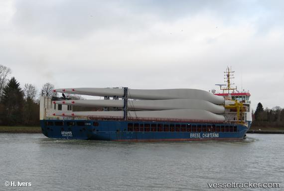
 ARAMIS
Current Status
Where is the vessel?
ARAMIS is currently in Near Plomárion, based on AIS data received about 14h ago.
Latest AIS update:
Current position: 38.98561° N, 26.15688° E (Near Plomárion)
Average speed (last 7 days): Loading…
Average speed (last 30 days): Loading…
Vessel profile: ARAMIS is a Cargo with dimensions m x m.
This page combines live AIS, route history, probable destination signals, nearby traffic, and port activity for practical vessel monitoring.
The current position of vessel ARAMIS is 38.98561 lat / 26.15688 lng. Updated: 2026-05-19 13:23:18 UTCNearest reference points:
- Near MITHYMNA
- Near Baba Point
- Near CESME
Currently sailing under the flag of Portugal ![]()
Details:
Live Vessel ARAMIS Analytics (details, animations, etc.)
Recent AIS points (UTC):
2026-05-19 10:05:49 UTC · 39.42995, 25.79888 · SOG 11.2 kn · COG 185°2026-05-19 10:08:48 UTC · 39.42061, 25.79781 · SOG 11.2 kn · COG 184°
2026-05-19 11:59:29 UTC · 39.09242, 25.84723 · SOG 11.1 kn · COG 113°
2026-05-19 13:23:18 UTC · 38.98561, 26.15688 · SOG 11.2 kn · COG 113°